In principio fu l’Uccellina
From a geological point of view, the Park territory is made up of two distinct areas: the Uccellina mountains and the plain around the last stretch of the Ombrone river.
The Uccellina mountains – actually a chain of hills parallel to the coast – were born about 5 million years ago following the lifting of the seabed under the pressure of the Sardinian-Corsican block. Those seabeds are formed by the two types of rocks that are encountered today on the paths of the Park: the “Verrucano” an orange or reddish conglomerate made up of fragments of quartz, feldspars and schistose rocks, held together by a siliceous-ferruginous cement, which dates back to about 250 million years ago, and the most recent massive limestone, about 25 million years ago.
For a very long time the Uccellina mountains were an island, but around 1.5 million years ago they joined the Italian peninsula thanks to the sediments brought by the Bruna and Ombrone rivers.
The history of the plain begins here.
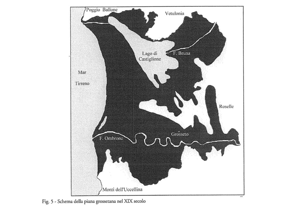
The large lagoon
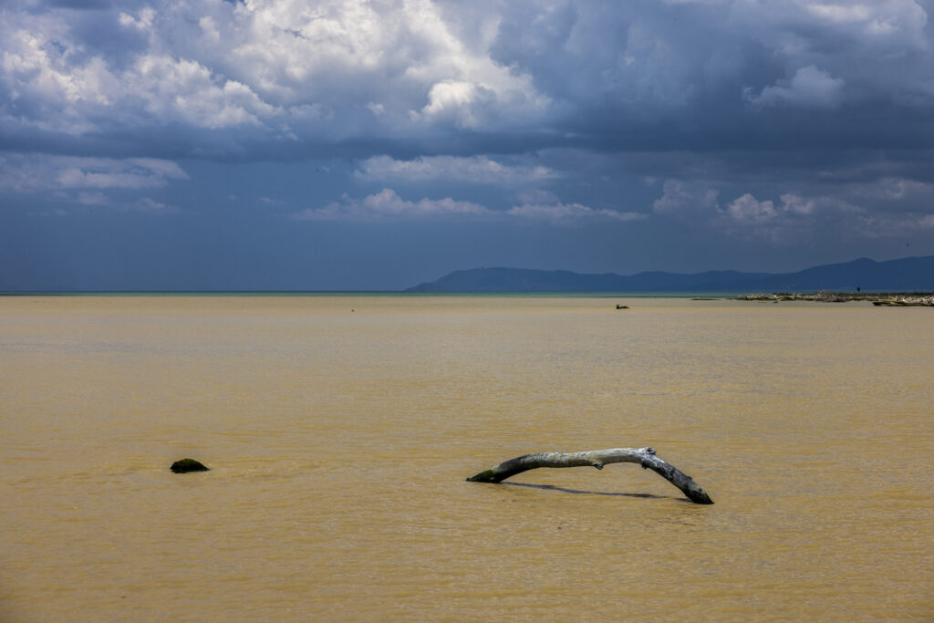
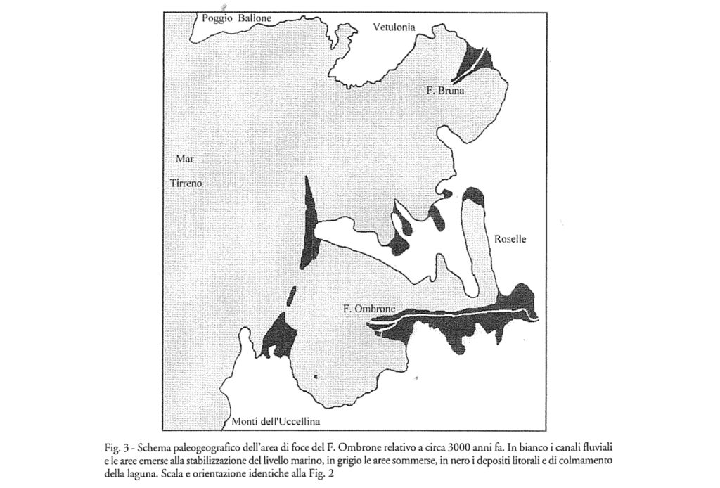
The Bruna and the Ombrone flow into a gulf which corresponds to the current Grosseto plain, on whose seabed sediments continue to accumulate year after year. The Ombrone, in particular, which descends from the Chianti mountains and the Crete Senesi, brings many of them: even today there are an average of 18 million tons per year.
Thus, between 5000 and 6000 years ago, the gulf had already transformed into a huge brackish lagoon, separated from the sea by a series of sand barriers accumulated by sea currents and the wind. Some openings between the barriers allow the exchange of water between the sea and the lagoon.
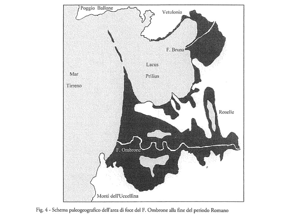
The filling of the lagoon began to accelerate in the Etruscan era, when the cities of Vetulonia and Roselle were built on its banks. In this era, in fact, the cutting of the forests on the inland hills began, which accelerated erosion. The colonization of the territory requires the opening of fields and pastures. The extraction of metals from the rocks of the nearby Colline Metallifere, custodians of the largest deposits in the Mediterranean, requires very large quantities of firewood. And wood is also used for heating, cooking and building. Deforestation became even more massive in Roman times, when the human population exploded and the region was among the richest and most populous in Italy. As time passes, therefore, the barrier with the sea tends to close more and more, the brackish water becomes increasingly sweeter, the lagoon begins to transform into a swamp, and the plain continues to advance towards the sea. The phenomenon slowed down after the fall of the Roman Empire and the depopulation of the region, when the woods grew back in the hinterland, but it resumed after the year 1000.
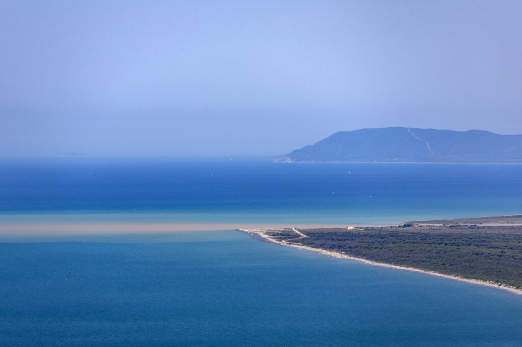
Further north, in front of Castiglione della Pescaia, Lake Castiglione, an immense, partially brackish marsh, will be preserved for a long time, while to the south the plain begins to form around the last stretch of the Ombrone course, today in the territory of Park.
The formation of the plain
The advancement of the coastline was particularly fast between 1300 and 1800, when it reached up to 10 meters per year. This is the period of the so-called “Little Ice Age”, characterized by lower temperatures and more intense winter rains, but it also coincides with the centuries of great development of the late Middle Ages, the Renaissance and beyond. The more forests are cut down, and the greater the intensity and frequency of floods, the more rapid soil erosion becomes, and the greater the transport of solid sediments towards the valley and the sea. Thanks to sediment dating, we now know in which era each point of the plain that today extends north of the Uccellina chain was formed.
Over the last century the advancement of the plain has stopped because the arrival of sediments has greatly decreased. In fact, inland the woods are growing back, and many dams built along the dammed waterways stop the transport of sediments downstream. Since 1950 the mouth of the Ombrone has even begun to retreat, eroded by the waves and marl currents. The great push and pull between the river and the sea is not over yet.
WHAT TO KNOW
WHERE TO GO